

Last month, Nepal’s ruling party had cleared the map, drawing fierce reaction from India, which described the move as “unilateral” and not based on historical facts
By Manish Kumar & Vishnu Som
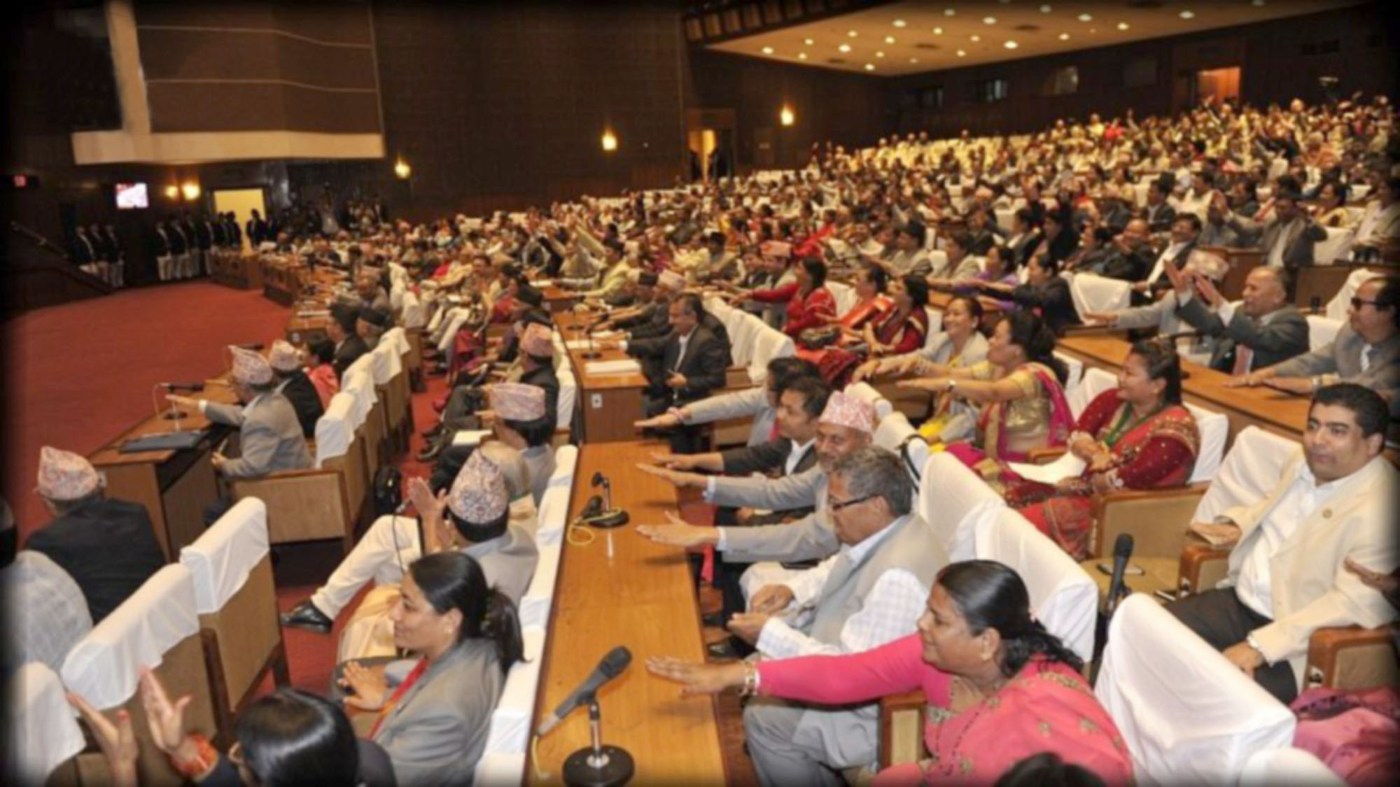
Nepal’s parliament on Saturday voted on a constitutional amendment bill in a special session to update the country’s map, which includes a stretch of land high in the mountains that India claims as its own. The House of Representatives opened the discussion on the amendment bill, which was put for voting after the deliberations were over.
All the 258 votes were in favour and the house has a total strength of 275, so the amendment bill was passed by a two-third majority. India, reacting to the new map, said this artificial enlargement of claims is not tenable. “We have noted that the House of Representatives of Nepal has passed a constitution amendment bill for changing the map of Nepal to include parts of Indian Territory.
We have already made our position clear on this matter,” India’s Foreign Ministry spokesperson Anurag Srivastava said on Saturday. “This artificial enlargement of claims is not based on historical fact or evidence and is not tenable. It is also violative of our current understanding to hold talks on outstanding boundary issues,” he added.
Last month, Nepal’s ruling party had cleared the map, drawing fierce reaction from India, which described the move as “unilateral” and not based on historical facts. The opposition Nepali Congress had said it would vote in favour of the amendment, amid friction with India over the issue. Now that it has been passed, it will be sent to the National Assembly where it will undergo a similar process.
The National Assembly will have to give lawmakers 72 hours to move amendments against the bill’s provisions, if any. After the National Assembly passes the bill, it will be submitted to the President for authentication, after which the bill will be incorporated in the Constitution.
The new map – made public last month – shows a sliver of land on the east of river Kali, jutting out from the northwestern tip of Nepal. The area includes the Lipulekh Pass in Uttarakhand and also Limpiyadhura and Kalapani, which are highly strategic areas which India has been guarding since the 1962 war with China.
Army Chief General MM Naravane on Saturday said that India has a very strong relationship with Nepal. “We have a very strong relationship with Nepal. We have geographical, cultural, historical, religious linkages. We have very strong people to people connect. Our relation with them has always been strong and will remain strong in the future,” General Naravane was quoted as saying by news agency ANI.